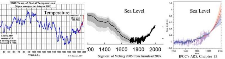
This looping video shows an umbrella cloud generated by the underwater eruption of the Hunga Tonga-Hunga Ha’apai volcano on Jan. 15, 2022. The GOES-17 satellite captured the series of images that also show crescent-shaped shock waves and lightning strikes.
Credit: NASA Earth Observatory image by Joshua Stevens using GOES imagery courtesy of NOAA and NESDIS
The huge amount of water vapor hurled into the atmosphere, as detected by NASA’s Microwave Limb Sounder, could end up temporarily warming Earth’s surface.
When the Hunga Tonga-Hunga Ha’apai volcano erupted on Jan. 15, it sent a tsunami racing around the world and set off a sonic boom that circled the globe twice. The underwater eruption in the South Pacific Ocean also blasted an enormous plume of water vapor into Earth’s stratosphere – enough to fill more than 58,000 Olympic-size swimming pools. The sheer amount of water vapor could be enough to temporarily affect Earth’s global average temperature.
“We’ve never seen anything like it,” said Luis Millán, an atmospheric scientist at NASA’s Jet Propulsion Laboratory in Southern California. He led a new study examining the amount of water vapor that the Tonga volcano injected into the stratosphere, the layer of the atmosphere between about 8 and 33 miles (12 and 53 kilometers) above Earth’s surface.
A warmth-demanding plant can provide us with solid evidence of a much warmer than today Mid-Holocene climate.
Growth of the tropical aquatic plant ceases when air temperatures fall below 10°C.
A new study says that from about 8000 to 5000 years ago it was warm enough in winter that could grow at the 40°N latitude in northern China. Today its warmth threshold growth limit is ~34°N.
Scientists can therefore deduce the Mid-Holocene winter temperatures needed to have been “7.7°C higher than today” at that time.
A new study (Boulila et al., 2022) suggests “abrupt and severe changes in Earth’s past climate” have been occurring at ~1,500-year periodicities since the iceless Jurassic period.
Warming events of degrees C per within decades or less were at one time thought to have occurred only at locations like Greenland and the North Atlantic during the last glacial period (70 to 12 thousand years ago).
But the evidence has been piling up from locations throughout the globe (e.g., on continents and tropical to high latitude oceans, lakes, and rivers) indicating these warming events have “a global interconnection between the two hemispheres.”
These “abrupt and severe” global warming events with ~1,500-year periodicities can even be traced back to the iceless Jurassic period when Antarctica was a rainforest and 38°C warmer than today. This suggests the driving force for these global warming periods were not dependent on ice sheet dynamics.
…
Abstract
Earth’s past climate exhibits short-term (1500-year) pronounced fluctuations during the last glacial period, called Dansgaard–Oeschger (DO) glacial events, which have never been detected in pre-Quaternary times. The record of DO equivalent climate variability in Mesozoic strata can provide constraints on understanding these events. Here we highlight a prominent 1500-year cyclicity in a Jurassic (~ 155 Ma) ice-free sedimentary record from the Tethyan Basin. This Jurassic 1500-year cyclicity is encoded in high-resolution magnetic susceptibility (MS) proxy data reflecting detrital variations, and expressed as marl-limestone couplets. Additionally, MS data detect the modulation of these DO-scale couplets by supercouplet sets, reflecting the precession and its harmonics. We suggest that this Jurassic DO-like cyclicity may originate from paleo-monsoon-like system, analogous to the record of DO events in the Pleistocene East Asian monsoon archives. Paleogeographic reconstructions and atmosphere–ocean simulations further support the potential existence of strong, ancient monsoon circulations in the Tethyan Basin during the Jurassic.
During late 2021, the Hunga Tonga-Hunga Ha’apai submarine volcano erupted creating a new island which erupted sub-aerially on 15thJanuary, 2022 sending a plume 58 km above sea level penetrating the mesosphere. The study of observation records including satellite data has revealed warming of the ocean-surface layer followed by atmospheric cooling caused by the release of geothermal heat and volcanic materials entering the atmosphere respectively. Environmental factors influencing weather include the development of a relatively ‘short’ life-span South Pacific Blob; the transfer of large quantities of water vapour from the ocean into the atmosphere; the low-pressure condition on the ocean surface; the formation of clouds; the reduction of solar radiation caused by volcanic materials in the atmosphere; the strengthening of trade winds; the meandering of jet streams; the development of atmospheric rivers, the additional cooling effect of torrential rainfall, and, the switch to La Niña conditions. The record rainfall in eastern Australia and New Zealand and Tropical Cyclone Dovi occurring in February 2022 were both outcomes of atmospheric cooling following the sub-aerial eruption.
It is widely accepted that atmospheric pO2 < 1 ppm before the Great Oxidation Event. Yet a recent study found fossil micrometeorites (MMs) containing the oxidized iron species wüstite (FeO) and magnetite (Fe3O4) formed 2.7 billion years ago (Ga). How these MMs became oxidized is uncertain. Abundant O2 in the upper atmosphere and iron oxidation by CO2 have been suggested. However, photochemical reactions cannot produce sufficient O2, and oxidation by CO2 can only produce FeO, each individually failing to explain the formation of Fe3O4-only MMs. Using an oxidation model of iron MMs including photochemistry, we show that a >32% CO2 Archean atmosphere and different entry angles can generate the Fe3O4-only and Fe-FeO mixed composition MMs that have been discovered. Oxidation happens in two stages: by CO2 under brief melting, then by O2. Our results challenge existing constraints on Earth’s atmospheric CO2 concentration at 2.7 Ga and support a warm Late Archean despite the ‘faint young Sun’.
True primates appeared suddenly on all three northern continents during the 100,000-yr-duration Paleocene–Eocene Thermal Maximum at the beginning of the Eocene, ≈55.5 mya. The simultaneous or nearly simultaneous appearance of euprimates on northern continents has been difficult to understand because the source area, immediate ancestors, and dispersal routes were all unknown. Now, omomyid haplorhine Teilhardinais known on all three continents in association with the carbon isotope excursion marking the Paleocene–Eocene Thermal Maximum. Relative position within the carbon isotope excursion indicates that Asian Teilhardina asiatica is oldest, European Teilhardina belgicais younger, and North American Teilhardina brandti and Teilhardina americana are, successively, youngest. Analysis of morphological characteristics of all four species supports an Asian origin and a westward Asia-to-Europe-to-North America dispersal for Teilhardina. High-resolution isotope stratigraphy indicates that this dispersal happened in an interval of ≈25,000 yr. Rapid geographic dispersal and morphological character evolution in Teilhardina reported here are consistent with rates observed in other contexts.
Digital signal processing technology was used to analyze daily carbon dioxide data from the joint NOAA – Scripps Oceanographic Institution’s Global Monitoring Laboratory (MLO). The period surrounding the 1991 eruption of the Pinatubo volcano was rigorously analyzed for slope and acceleration of net global average atmospheric CO2 concentration and found to be consistent with the theory that Henry’s Law, the Law of Mass Action, and Le Chatelier’s principle control net global average atmospheric CO2 concentration rather than human-produced CO2 emissions. Background and theory are explained. A method of using common physics and math for a novel purpose is presented to compare natural CO2emission or absorption with human-produced CO2 emission. The claim that human-produced CO2 emission is causing increasing global CO2 concentration and climate change is shown to be without scientific merit.
Permafrost developed from Termination Ia (Bölling interstadial, 14.5 cal ka BP) in Northern Iceland, in answer to deglaciation. Permafrost persisted or even re-extended during the Preboreal cooling events (at 11.2, 10.3 and 9.3 cal ka BP) synchronic with pulsated glacial advances. It disappeared below 1000 masl during the Thermal Optimum (8-5 cal ka BP). The present-day re-extent was controlled with the cooling related with the Little Ice Age and particularily the Maunder solar Minimum. Continuous permafrost is stable above 1000 masl, but is today melting between 900 and 800 masl. Discontinuous permafrost is vanishing today with the recent climate warming (from 1970), especially in palsa bogs, and on valley slopes with thermokarstic mass wasting.
The recession of the Hornbreen-Hambergbreen glaciers (Hornsund, Svalbard) will lead to the formation of a strait between the Greenland and Barents Seas within a few decades. We provide evidence for the earlier existence of this strait, in the Early–Middle Holocene and presumably since 1.3 ka cal. BP until glacier advance 0.7 ± 0.3 ka or earlier. Radiocarbon dating of mollusc shells from the ground moraines in the Hornbreen forefield indicate the existence of the marine environment at the contemporary glacierized head of Hornsund since 10.9 ka cal. BP or earlier due to glacier retreat. The gap in the radiocarbon dates between 3.9 and 1.3 ka cal. BP and the published results of 10Be exposure dating on Treskelen suggest the strait’s closure after glacier advance in the Neoglacial. Subsequent re-opening occurred around 1.3 ka cal. BP, but according to 10Be dates from Treskelen, the strait has again been closed since ca. 0.7 ± 0.3 ka or earlier. The oldest known surge of Hornbreen occurred around 1900. Analysis of Landsat satellite images, morphometric indicators characterizing the glacier frontal zones and previous studies indicate one surge of Hambergbreen (1957–1968) and five re-advances of Hornbreen in the 20th century (after 1936, between 1958 and 1962, in 1986–1990, 1998–1999, 2011). While the warmer Holocene intervals might be a benchmark for the effects of future climate change, glacier dynamics in post-Little Ice Age climate warming seems to be an analogue of glacier retreats and re-advances in the earlier periods of the Holocene.
Yes, I do know that acceleration, technically, means just a change in velocity. But, in every day English, we use acceleration to mean an increase in velocity – speeding up — and deceleration as a decrease in velocity – slowing down. I mention acceleration and deceleration because one of the major talking points of IPCC reported findings about sea level rise, the incessant media mantra, is that “Sea Level Rise is Accelerating”. (here, here, here, here, here and hundreds more here)
Is sea level rising? Yes, of course it is. It has been rising since about 1750-1775, coinciding with the end of the Little Ice Age. This is widely accepted as shown below:
How do we know? The important aspect of sea level is how it affects the land at the edges of the oceans. The water level there is measure by tide gauges at the ports and harbors of the world. The levels recorded by tide gauges are of local Relative Sea Level (RSL) – the level at which the sea surface hits the land. This measurement includes both the actual rise in the sea surface height (think: distance from the center of the Earth) plus any vertical movement (VLM) of the tide gauge itself, either up or down. In many locations the land mass itself is subsiding (sinking) due to glacial isostatic adjustment (GIA) as the land mass readjusts itself for the melting of the glaciers of the last great Ice Age and at most tide gauge locations, the structure to which the tide gauge tself is attached, such as a pier or dock or sea wall, is also itself subsiding due to compaction of the soil underneath and the fact that many such locations are built on man-made filled substrate. To see if sea level is rising, it is only necessary to look at high quality tide gauge records for whom the VLM is known to be relatively constant. The linearity of these graphs is typical, there are many, many more.
Received on 18 February 2022; revised on 20 March 2022; accepted on 22 March 2022
Abstract:
The “100,000-year problem” refers to an apparent unexplained change in the frequency of inter-glacial periods which occurred about a million years ago. Before that, inter-glacial periods seemed to occur about every 41,000 years, in line with the obliquity Milankovich cycle. But after that, they seemed to occur about every 100,000 years, in line with the orbital inclination Milankovich cycle. Examination of the data shows that there never was a 41,000-year cycle, and that there is no 100,000-year cycle, but that the most influential cycle is the approx 21,000-year precession cycle which is the major factor in the cycles of insolation at higher latitudes. Insolation at 65N is generally regarded as the most significant of these. Inspection of the data shows that every glacial termination (start of an inter-glacial period) began at a time when insolation at 65N increased from a low point in its cycle. That not every such cycle triggered a new inter-glacial period underlines the chaotic non-linear nature of Earth’s climate. Until about a million years ago, this cycle occasionally “missed a beat”, making the inter-glacial frequency average about 41,000 years. After that, the cycle started missing more “beats”, making the inter-glacial frequency average about 100,000 years. There never was an actual 41,000-year or 100,000-year inter-glacial cycle.
(a) Location of the main components of the West Antarctic Rift System and confirmed volcanoes (red circles: after LeMasurier et al. 1990; Smellie & Edwards 2016). (b) Location of Holocene volcanoes (red circles) in the Ethiopia/Kenya branch of the East African Rift (red shaded area). The majority of this activity is aligned along the rift axis with occasional flank volcanism. Data from Siebert & Simkin (2002) and Global Volcanism Program (2013).
Abstract
The West Antarctic Ice Sheet overlies the West Antarctic Rift System about which, due to the comprehensive ice cover, we have only limited and sporadic knowledge of volcanic activity and its extent. Improving our understanding of subglacial volcanic activity across the province is important both for helping to constrain how volcanism and rifting may have influenced ice-sheet growth and decay over previous glacial cycles, and in light of concerns over whether enhanced geothermal heat fluxes and subglacial melting may contribute to instability of the West Antarctic Ice Sheet. Here, we use ice-sheet bed-elevation data to locate individual conical edifices protruding upwards into the ice across West Antarctica, and we propose that these edifices represent subglacial volcanoes. We used aeromagnetic, aerogravity, satellite imagery and databases of confirmed volcanoes to support this interpretation. The overall result presented here constitutes a first inventory of West Antarctica’s subglacial volcanism. We identified 138 volcanoes, 91 of which have not previously been identified, and which are widely distributed throughout the deep basins of West Antarctica, but are especially concentrated and orientated along the >3000 km central axis of the West Antarctic Rift System.
Large volcanic eruptions occurring in the last glacial period can be detected by their accompanying sulfuric acid deposition in continuous ice cores. Here we employ continuous sulfate and sulfur records from three Greenland and three Antarctic ice cores to estimate the emission strength, the frequency and the climatic forcing of large volcanic eruptions that occurred during the second half of the last glacial period and the early Holocene, 60–9 kyr before 2000 CE (b2k). Over most of the investigated interval the ice cores are synchronized, making it possible to distinguish large eruptions with a global sulfate distribution from eruptions detectable in one hemisphere only. Due to limited data resolution and large variability in the sulfate background signal, particularly in the Greenland glacial climate, we only list Greenland sulfate depositions larger than 20 kg km−2 and Antarctic sulfate depositions larger than 10 kg km−2. With those restrictions, we identify 1113 volcanic eruptions in Greenland and 737 eruptions in Antarctica within the 51 kyr period – for which the sulfate deposition of 85 eruptions is found at both poles (bipolar eruptions). Based on the ratio of Greenland and Antarctic sulfate deposition, we estimate the latitudinal band of the bipolar eruptions and assess their approximate climatic forcing based on established methods. A total of 25 of the identified bipolar eruptions are larger than any volcanic eruption occurring in the last 2500 years, and 69 eruptions are estimated to have larger sulfur emission strengths than the Tambora, Indonesia, eruption (1815 CE). Throughout the investigated period, the frequency of volcanic eruptions is rather constant and comparable to that of recent times. During the deglacial period (16–9 ka b2k), however, there is a notable increase in the frequency of volcanic events recorded in Greenland and an obvious increase in the fraction of very large eruptions. For Antarctica, the deglacial period cannot be distinguished from other periods. This confirms the suggestion that the isostatic unloading of the Northern Hemisphere (NH) ice sheets may be related to the enhanced NH volcanic activity. Our ice-core-based volcanic sulfate records provide the atmospheric sulfate burden and estimates of climate forcing for further research on climate impact and understanding the mechanism of the Earth system.How to cite. Lin, J., Svensson, A., Hvidberg, C. S., Lohmann, J., Kristiansen, S., Dahl-Jensen, D., Steffensen, J. P., Rasmussen, S. O., Cook, E., Kjær, H. A., Vinther, B. M., Fischer, H., Stocker, T., Sigl, M., Bigler, M., Severi, M., Traversi, R., and Mulvaney, R.: Magnitude, frequency and climate forcing of global volcanism during the last glacial period as seen in Greenland and Antarctic ice cores (60–9 ka), Clim. Past, 18, 485–506, https://doi.org/10.5194/cp-18-485-2022,
IMAGE: LEAD AUTHOR SINJINI SINHA, A GRADUATE STUDENT AT THE UNIVERSITY OF TEXAS AT AUSTIN’S JACKSON SCHOOL OF GEOSCIENCES, EXAMINES IMAGES OF FOSSIL SPECIMENS IN THE SCANNING ELECTRON MICROSCOPE LAB. SINHA USED THE MICROSCOPE TO EXAMINE EXCEPTIONALLY PRESERVED FOSSILS AND LEARN MORE ABOUT THE FOSSILIZATION PROCESS.view more
CREDIT: THE UNIVERSITY OF TEXAS AT AUSTIN/JACKSON SCHOOL OF GEOSCIENCES.
Climate change can affect life on Earth. According to new research, it can also affect the dead.
A study of exceptionally preserved fossils led by a graduate student at The University of Texas at Austin has found that rising global temperatures and a rapidly changing climate 183 million years ago may have created fossilization conditions in the world’s oceans that helped preserve the soft and delicate bodies of deceased marine animals.
The fossils include squid-like vampyropods with ink sacs, ornate crustacean claws and fish with intact gills and eye tissue.
Despite being from different locations and marine environments, the fossils were all preserved in a similar manner. Geochemical analysis revealed that the conditions needed to preserve such captivating fossils could be connected to Earth’s climate.
“When I started the research, I had no idea if they would preserve the same way or a different way,” said lead author Sinjini Sinha, a graduate student at the UT Jackson School of Geosciences. “I was curious what led to the exceptional preservation.”
The study examined the rates and patterns of vertical land motion (VLM) on all locations on Earth’s land surface using GPS imaging. The team estimated the VLM at all tide gauges. The authors were able to make a global assessment of the budget of uplift and subsidence attributable to glacial isostatic adjustment (GIA) and non-GIA sources and provide maps and rates at over 2,300 tide gauges around the world.
The results led the authors to conclude that the surface motion of the continents is on average upward, implying that the unobserved areas (composed of the ocean basins and ice-covered areas) move on average downward with respect to Earth center.
…
Less than 1% of the stations are on track to reach the IPCC projection
Other scientific studies show zero or even negatively accelerating sea level rise at many locations measured by tide gauges. See here.
For example, the NOAA keeps a coastal station tide list for tracking global linear relative sea level (RSL). The data and charts can be looked at country-by-country here. Overall, only 3 stations show a RSL rise of 7.5 mm/year or more, meaning only three stations (0.08%) are on track to reach the IPCC’s alarmist 75 cm sea level rise projection by 2100.
And if we use the more conservative and realistic 60 cm rise, only 5 stations (1.4%) are on track.
However, after correcting for the GIA the reverse is true, and observed areas subside on average implying that the unobserved areas undergo net non-GIA-related uplift.
Radiocarbon dating from a prehistoric cemetery in Northern Russia reveals human stress caused by a global cooling event 8,200 years ago Early hunter gatherers developed more complex social systems and, unusually, a large cemetery when faced by climate
Radiocarbon dating from a prehistoric cemetery in Northern Russia reveals human stress caused by a global cooling event 8,200 years ago
Early hunter gatherers developed more complex social systems and, unusually, a large cemetery when faced by climate change
New insight into how our early ancestors dealt with major shifts in climate is revealed in research, published today [27 Jan] in Nature Ecology & Evolution, by an international team, led by Professor Rick Schulting from Oxford University’s School of Archaeology.
It reveals, new radiocarbon dates show the large Early Holocene cemetery of Yuzhniy Oleniy Ostrov, at Lake Onega, some 500 miles north of Moscow, previously thought to have been in use for many centuries, was, in fact, used for only one to two centuries. Moreover, this seems to be in response to a period of climate stress.
Researchers in Japan, Sweden, and the US have unearthed evidence that low volcanic temperatures led to the fourth mass extinction, enabling dinosaurs to flourish during the Jurassic period.
Large volcanic eruptions create climatic fluctuations, ushering in evolutionary changes. Yet it is the volcanic temperature of the eruption that determines whether the climate cools or warms.
Since the emergence of early animals, five mass extinctions have taken place. The fourth mass extinction occurred at the end of the Triassic Period – roughly 201 million years ago. This mass extinction saw many marine and land animals go extinct, especially large-body, crocodilian-line reptiles known as pseudosuchia. Approximately 60-70% of animal species disappeared. As a result, small bodied dinosaurs were able to grow and prosper.
Scientists think the fourth mass extinction was triggered by the eruptions in the Central Atlantic Magmatic Province – one of the largest regions of volcanic rock. But the correlation between the eruption and mass extinction has not yet been clarified.
Using analysis of sedimentary organic molecules and a heating experiment, current professor emeritus at Tohoku University, Kunio Kaiho and his team demonstrated how low temperature magma slowly heated sedimentary rocks, causing high sulfur dioxide (SO2) and low carbon dioxide emissions (CO2).
Greta Thunberg rejects all ideas of the enlightenment. Despite what she wails, she is now living in the best times ever to be a child on planet Earth. She can actually go to FLOP26, something that few of us would want to do. Would she prefer to live in the worst of times when there was panic, suffering, environmental damage, death and no hope which she claims exists today?
We now eat better, are less affected by natural disasters and are able to cope with extremes of weather and climate. During the last 4 of at least 20,000 generations of humans, child mortality has decreased and global human longevity increased from 25 to 79 years. The climate moaners need to get some perspective from history.
The worst years to live since the time of Jesus were 535-550 AD because massive volcanic eruptions, perhaps Kamchatka or Alaska in 535-536 AD and Ilopango in El Salvador from 539-540 AD. The Northern Hemisphere atmosphere with filled with dust and acid sulphate clouds. These volcanic eruptions were coincidental with extraterrestrial impacts in March 536 AD in the Gulf of Carpentaria and elsewhere in August 536 AD. To make matters worse, these were at the time of a Solar Minimum.
The Sun was dimmed for 18 months, a white sulphuric acid aerosol cloud enveloped Europe, global temperature dropped by 1.5 to 2.5°C producing worldwide crop failures and death by starvation. There was migration (e.g. Slavic speaking people), political turmoil and the collapse of empires (e.g. Sasanian Empire in Persia). Tree rings show almost no growth for a few years.
The PETM or Paleocene-Eocene Thermal Maximum was a warm period that began between 56.3 and 55.9 Ma (million years ago). The IPCC AR6 report (actually a draft, not a final edited report), released to the public on August 9, 2021, suggests that this warm period is similar to what is happening today and they expect to happen in the future (IPCC, 2021, pp. 2-82 & 5-14). During the PETM, it was very warm and average global surface temperatures probably peaked between 25.5°C and 26°C briefly, compared to a global surface temperature average of about 14.5°C today, as shown in Figure 1.
….
oday we have tens of thousands of daily temperature measurements around the world and can calculate a fairly accurate global average surface temperature. To construct a global average for the PETM we must rely on proxy temperatures, such as oxygen isotope ratios, Calcium/Magnesium ratios in fossil shells, and fossil membrane lipids that are sensitive to temperature like Tex86. Proxy temperature values are sparsely located and have a temporal resolution, 56 Ma, of thousands to hundreds of thousands of years. Thus, in terms of rate of temperature change, they are not comparable to today’s monthly global averages.
Before diving into the PETM, we will provide some geological perspective. According to Christopher Scotese, the highest global average temperature in the Phanerozoic (the age of complex shelled organisms, or the past 550 million years) was the Triassic hothouse event, following the end of the Karoo Ice Age, around 250-300 Ma. Global average surface temperatures peaked then at about 27.9°C.
Nyiragongo’s deadliest eruption in history was that of 1977 (during the weak solar minimum of cycle 20) — this event went down as a VEI 1, according to historical observations, yet still managed to kill more than 600 people.
Saturday evening’s eruption looks bigger.
This was likely the volcano’s strongest eruption in recorded history.
…
…
UPTICK
Seismic and Volcanic activity has been correlated to changes in the Sun.
The recent global uptick in earthquakes and volcanic eruptions is likely attributed to the drop-off in solar activity, coronal holes, a waning magnetosphere, and the increase in Galactic Cosmic Rays penetrating silica-rich magma.
Both NOAA and NASA appear to agree, if you read between the lines, with NOAA saying we’re entering a ‘full-blown’ Grand Solar Minimum in the late-2020s, and NASA seeing this upcoming solar cycle (25) as “the weakest of the past 200 years”, with the agency correlating previous solar shutdowns to prolonged periods of global cooling here.
Furthermore, we can’t ignore the slew of new scientific papers stating the immense impact The Beaufort Gyre could have on the Gulf Stream, and therefore the climate overall.
HH Lamb’s Climate, History and The Modern World tells us much about the history of Alpine glaciers. For instance, how they advanced rapidly between 800 and 400 BC. They then retreated before advancing again between AD 600 and AD 850, when they may have even reached Little Ice Age maximum extents.
We are probably all familiar with the terrifying glacier advances, which began in the 17thC, following centuries of a much warmer climate. These were catastrophic for anybody living nearby, as farming land was wiped out, and even the land that escaped being overrun was far too cold to farm. As a result, famine was rife in Switzerland and elsewhere, even in cities which relied on the countryside for food.
People living in those days would have been dumfounded to hear that there are some now who are worried that glaciers are getting smaller.
A paper by Zumbuhl et al, published in 2006, offers a detailed history of the Lower Grindelwald glacier, as well as the Mer de Glace in the Mont Blanc region:
In 1958, a magnitude 7.8 earthquake triggered a rockslide into Southeast Alaska’s Lituya Bay, creating a tsunami that ran 1,700 feet up a mountainside before racing out to sea.
Researchers now think the region’s widespread loss of glacier ice helped set the stage for the quake.
In a recently published research article, scientists with the University of Alaska Fairbanks Geophysical Institute found that ice loss near Glacier Bay National Park has influenced the timing and location of earthquakes with a magnitude of 5.0 or greater in the area during the past century.
Scientists have known for decades that melting glaciers have caused earthquakes in otherwise tectonically stable regions, such as Canada’s interior and Scandinavia. In Alaska, this pattern has been harder to detect, as earthquakes are common in the southern part of the state.
Alaska has some of the world’s largest glaciers, which can be thousands of feet thick and cover hundreds of square miles. The ice’s weight causes the land beneath it to sink, and, when a glacier melts, the ground springs back like a sponge.
“There are two components to the uplift,” said Chris Rollins, the study’s lead author who conducted the research while at the Geophysical Institute. “There’s what’s called the ‘elastic effect,’ which is when the earth instantly springs back up after an ice mass is removed. Then there’s the prolonged effect from the mantle flowing back upwards under the vacated space.”
In the study, researchers link the expanding movement of the mantle with large earthquakes across Southeast Alaska, where glaciers have been melting for over 200 years. More than 1,200 cubic miles of ice have been lost.
Southern Alaska sits at the boundary between the continental North American plate and the Pacific Plate. They grind past each other at about two inches per year — roughly twice the rate of the San Andreas fault in California — resulting in frequent earthquakes.
Is climate change real? Journalists in Canada have had a field day with that question since it was debated at the Conservative Party policy meeting on March 20, 2021. It is the perfect question to ask if you want to boil a mind-numbingly complex set of issues into a simple question that can be used to misinform and confuse people. The proper answer to that question is another one. To what part of the climate policy conundrum are you referring?
You see, the “realness” (or truthfulness, or even importance) of climate policy depends on the answer to several questions, not one. Let’s break them down, and comment ever so briefly on the possible answers.
Is global warming occurring?
The global climate has been changing for millions of years, with temperatures rising and falling. They were as high as they are today during Roman times and the Medieval Warm Period. Since 1850, global average temperatures have risen slightly more than one degree Celsius.
A “seismic crisis” has been occurring in the area near Fagradalsfjall since late Feb 2021. This activity has been interpreted as intrusion of magma at shallow depths, which could lead to a new eruption.
Fadradalsfjall is a Pleistocene table mountain in the Reykjanes Peninsula, NE of Grindavik, Iceland.
…
…
Of today’s reawakening volcanoes, those located in Iceland are perhaps the most concerning.
It is this highly-volcanic region that will likely be home to the next “big one” (a repeat of the 536 AD eruption that took out the Roman Republic…?) — the one that will return Earth to another volcanic winter.
Volcanic eruptions are one of the key forcings driving Earth into its next bout of global cooling.
Volcanic ash (particulates) fired above 10km –and so into the stratosphere– shade sunlight and reduce terrestrial temperatures. The smaller particulates from an eruption can linger in the upper atmosphere for years, or even decades+ at a time.
Today’s worldwide volcanic uptick is thought to be tied to low solar activity, coronal holes, a waning magnetosphere, and the influx of Cosmic Rays penetrating silica-rich magma.
Both NOAA and NASA appear to agree, if you read between the lines, with NOAA saying we’re entering a ‘full-blown’ Grand Solar Minimum in the late-2020s, and NASA seeing this upcoming solar cycle (25) as “the weakest of the past 200 years”, with the agency correlating previous solar shutdowns to prolonged periods of global cooling here.
Furthermore, we can’t ignore the slew of new scientific papers stating the immense impact The Beaufort Gyre could have on the Gulf Stream, and therefore the climate overall.
La géologie, une science plus que passionnante … et diverse