Archives par mot-clé : Snow

Is the Low Snowpack this Year a Sign of Global Warming?

C. Mass, Jan1, 2024 in WUWT


El Nino

We are in a very strong El Nino and such events are highly correlated with warm winter temperatures and poor snowpack over the region.  Sea surface temperatures have been about 2C above normal over the past two months (see below).

According to NOAA/NWS, El Nino years are associated with warmer than normal October-November-Decembers (see below for a local climate division)

Antarctic Ice Cap To Grow Despite Global Warming–New Study

by P. Homewood, Mar 29, 2023 in NotaLotofPeopleKnowThat


This study seems to have gone under the radar last year:

https://doaj.org/article/df360f90269148b181055b409cd38204

So in short, under high emission scenarios, they reckon that the Antarctic ice cap will actually grow, with heavier snowfall more than offsetting glacial melt, leading to lower sea levels. And even under lower emissions the rate of melt will still be lower than currently.

Indeed according to scientists like Jay Zwally, the Antarctic ice cap has actually been growing in recent decades, for precisely this reason.

From Record Snow To No Snow, Activist Media Use Climate Change To Stoke Fear

by J. Heller, Mar 7, 2023 in ClimateChangeDispatch


This article is in the tradition of articles that we have seen for decades saying we could look forward to snowless winters because of humans and our use of natural resources.

What is missing from every one of these articles is a direct link connecting oil consumption, CO2 content, or any other such thing with temperatures and snow. [emphasis, links added]

But the truth has never mattered to the media and other leftists when they have set out to destroy the oil industry.

They cannot explain why we had a cooling period from 1940 to 1975, where essentially the same people who are warning of an existential threat of warming were warning of an existential threat that billions would die from an existential threat of a coming ice age.

Here is a hint for sycophant journalists who just repeat what they are told.

Greenland’s 2021 spring: more snow, less melt

by C. Rotter, July 14, 2021 in WUWTfromNSIDC


Surface melt and total melt-day area for the Greenland Ice Sheet at the end of the 2021 spring season was below the 1981 to 2010 average. Snowfall and rain (minus runoff) added mass to the ice sheet. As of June 20, total mass gain for the ice sheet since September 2020 was slightly above average. The spike from June 25 to June 27 will be discussed in later a post.

Surprising Results: Global Snowfall Rate Increases 3% Over The Past 40 Years

by P. Gosselin, May 5, 2021 in NoTricksZone


Blogger Zoe Phin was curious about global snowfall trend in our era of “extreme global warming”. The results of a comprehensive analysis provide a surprise. 

To find out what the global snowfall trend has been, the hotshot data analyst diligently downloaded all available monthly NASA images from 1980 to 2020 (inclusive), such as the one shown below, and then converted the pixel colors back to data using the provided scale.

Here over the past 40 years snowfall has indeed grown from 0.6257 to 0.7057 decigrams/m2/s, or +12.77%. This trend, like many, is not global.

It just goes to show that when it comes to the chaotic system of climate, things are never simple and researchers get surprised almost daily.

You can generate your own charts using data archived here.

End of Snow? Finland Thinks Their Winter Snow Might Not Melt This Summer

by E. Worall, March 23, 2021 in WUWT


Finland thinks that piles of snow accumulated from road clearing this year are so large, some of the snow will still be frozen when winter returns.

In Finnish capital region, snow piles built up this winter may not melt during summer

FINLAND  15 MARCH 2021

THE CAPITAL REGION of Finland has received so much snow this winter that the metres-high piles hauled to designated snow dump areas may not melt during the course of the summer, reports Helsingin Sanomat.

In Uusimaa, for example, the amount of snow was 1.7 times higher than last year in January, according to Foreca.

Helsingin Sanomat on Friday wrote that the piles of snow stand almost as high as 20 metres at the dump area in Herttoniemi, eastern Helsinki. In Maununneva, a north-western neighbourhood of the city, lorries have dumped roughly 16,000 loads of snow at the dump area, revealed Tero Koppinen, a production manager at Helsinki City Construction Services (Stara).

The snow ploughed from roads forms a large structure, nicknamed by the locals as the Alps, also at the only snow dump area in Espoo, in Vanttila.

Read more: https://www.helsinkitimes.fi/finland/finland-news/domestic/18867-snow-piles-built-up-this-winter-may-not-melt-during-summer-in-finnish-capital-region.html

The Fins mostly seem to be treating this as a joke, maybe a chance to cool off on warm Summer days. And most likely this event will have no long term consequences.

End of Snow? Finland Thinks Their Winter Snow Might Not Melt This Summer

by Eric Worall, March 22, 2021 in WUWT


Finland thinks that piles of snow accumulated from road clearing this year are so large, some of the snow will still be frozen when winter returns.

In Finnish capital region, snow piles built up this winter may not melt during summer

FINLAND  15 MARCH 2021

THE CAPITAL REGION of Finland has received so much snow this winter that the metres-high piles hauled to designated snow dump areas may not melt during the course of the summer, reports Helsingin Sanomat.

In Uusimaa, for example, the amount of snow was 1.7 times higher than last year in January, according to Foreca.

Helsingin Sanomat on Friday wrote that the piles of snow stand almost as high as 20 metres at the dump area in Herttoniemi, eastern Helsinki. In Maununneva, a north-western neighbourhood of the city, lorries have dumped roughly 16,000 loads of snow at the dump area, revealed Tero Koppinen, a production manager at Helsinki City Construction Services (Stara).

The snow ploughed from roads forms a large structure, nicknamed by the locals as the Alps, also at the only snow dump area in Espoo, in Vanttila.

Read more: https://www.helsinkitimes.fi/finland/finland-news/domestic/18867-snow-piles-built-up-this-winter-may-not-melt-during-summer-in-finnish-capital-region.html

The Fins mostly seem to be treating this as a joke, maybe a chance to cool off on warm Summer days. And most likely this event will have no long term consequences.

But history teaches that when ice ages strike, they can strike abruptly, with very little warning.

12,800 years ago, the world abruptly froze. Temperatures plunged back to ice age conditions, and stayed cold for over 1000 years.

AT LEAST 13 DEAD, HUNDREDS HOSPITALIZED AS RECORD SNOWSTORMS SWEEP JAPAN

by Cap Allon, Jan 23, 2021 in Electroverse


Following the historic snowstorms of the past few weeks, Japan has been hit again: at least 13 people died and more than 250 were injured as record snowfall blanketed regions along the Sea of Japan coast, according to the latest report by the nation’s Disaster Management Agency.

Among those to have lost their lives were three people in Fukui Prefecture, and four in Niigata Prefecture, all reportedly while trying to remove the snow which topped a whopping 3.13 meters (10.3 feet) in some areas.

According to Japan’s Meteorological Agency (JMA), at least 10 monitoring stations along the Sea of Japan set new all-time 72-hour snowfall records late on Jan. 10, and many more busted all-time low temperature records, including in Furue, Kamigoori, and Kuzakai–with the latter logging a bone-chilling -24C (-11F).


The Guardian: Children Won’t Know what Snow Is – AGAIN

by E. Worall, Dec 8, 2020 in WUWT


h/t James Delingpole / Breitbart; One of the most widely mocked alarmist predictions ever :- In the year 2000, Dr. David Viner beclowned himself by announcing that thanks to Global Warming, “children just aren’t going to know what snow is” (see the web archive – the original was deleted). Now Dr Lizzie Kendon of the UK MET office has followed Viner’s footsteps, by suggesting “much of the snow will have disappeared entirely” by the end of the century.


SUBSTANTIAL EARLY-DECEMBER SNOW FORECAST TO BLANKET THE UK AND EUROPE: 11 FOOT (3.28 METRES) PREDICTED IN THE ALPS

by Cap Allon, Dec 2, 2020 in Electroverse


The UK is set for a flurry of heavy and rare early-December snow this week, with even far southern regions on course for disruptive accumulations.

The first dusting is expected to arrive across the northern half of the UK today, Dec. 2, and more will follow in the coming days, to more southern regions, too, as a descending Arctic blast tightens its grip on the nation.

Heavy snow is likely to have buried vast swathes of the country by Friday, with forecasters suggesting the bitter wintry mix could even rage on until the middle of next week -at least- with hard frosts also expected: “In the clear periods between bands of wintry showers, frosts are likely and these could be sharp or even severe in prolonged clear conditions in north-western parts of the UK,” warns Steve Ramsdale, Chief Meteorologist at the Met Office.

Over the next 5 days alone, latest GFS runs reveal Britain will be hit by a substantial smattering of early-season snow as frigid polar air rides anonymously-far south on the back of a meridional jet streama setup shown to increase during times of low solar activity–such as we’re suffering now:


NORTHERN HEMISPHERE SNOW MASS ABOVE AVERAGE + GREENLAND ICE SHEET’S ASTONISHING GAINS CONTINUE

by Cap Allon, Oct 21, 2020 in Electroverse


Following on from one of its snowiest winters on record in 2019-20 comes the first 2020-21 data-points from the Finnish Meteorological Institute (FMI). What they clearly reveal is that the Northern Hemisphere is at it again, continuing the trend of growth observed in recent years.

Despite decades of doom-and-gloom prophecies and fear-mongering claptrap, the Northern Hemisphere continues to GAIN “snow mass” at a rate comfortably above the 1982-2012 average:


….

See also here (Minnesota just suffered its Largest Early-Season Snowstorm in Recorded History)

ARGENTINA HOLDS 8C TO 16C BELOW AVERAGE AS 2 FEET OF SNOW BURIES USHUAIA PROVINCE

by Cap Allon, Oct 4, 2020 in Electroverse


The out-of-season cold and snow currently blasting BOTH HEMISPHERES is intensifying: North America, western/northern Europe, central/eastern Asia, and practically ALL of Australia have now been joined by Argentina.

The South American nation of Argentina measures 2,175 miles long and lies between 21°S and 55°S. Despite its impressive latitude spanning length, the country has been completely engulfed by a powerful Antarctic blast.

Looking at the latest GFS run (shown below), Argentina is set to suffer temperature departures as much as 16C below the seasonal average on Sunday, Oct 4:

Remember when we were told: “The Arctic Is On Fire, and We Should all Be Terrified”? It’s SNOWING there now.

by Anthony Watts, July 7, 2020 in WUWT


From the “weather is not climate”, you идиот department comes this about face by climate change nature.

Remember just a couple of weeks ago we were lectured to about the dangers of climate change turning towns around the Arctic circle into easy-bake ovens?

Well, I pointed out how absurd this all was, especially since it also happened 100 years ago, before the climate change was even a glimmer in leftists eyes. And, because with 24 hour sunlight at the peak of the summer solstice, the area is bound to get hot, because there’s no “night” to cool off. Of course, that didn’t stop opportunistic trough-feeding scientists like Mark “the Arctic is screaming” Serreze from taking advantage of the situation, claiming it was all part of a disturbing pattern.

Naturally, the visual that was produced on Twitter to scare people was pretty convincing to the non-thinking media types that pounced on the story.

RECORD SNOWFALL BURIES UPPER MIDWEST — SIERRA NEVADA MOUNTAINS TO SEE 4-FEET ON SUNDAY — NH SNOW MASS 500 GIGATONS ABOVE 1982-2012 AVERAGE

by Cap Allon, April 5, 2020 in Electroverse


According to abcnews.go.com and the NWS, seven states from Minnesota to Kansas were under ice and snow alerts on Friday, while forecasts for the West see 4-feet of snow falling over the Sierra through Sunday alone.

Thursday, April 2 saw record Spring snowfall bury the Upper Midwest.

In Grand Forks, North Dakota, a whopping 10 inches (25.4 cm) of global warming goodness was measured; while Fargo, North Dakota, saw snow totals touch 5 inches (12.7 cm).

Wyoming was handed the largest accumulations — a recording busting 21 inches (53.3cm).

This cold front continued its slow southerly march overnight Thursday, and reached southeastern Texas by Friday afternoon — the biggest impacts here were severe thunderstorms, damaging winds, golf-ball size hail, and the odd tornado. Heavy rain also reportedly produced some flash flooding.

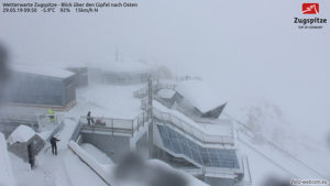
A new storm rolled into the West Coast on Saturday bringing heavy rain to the California coast. Looking forward to Sunday, staggering April snow totals of up to 4 FEET are forecast to bury the Sierra Nevada Mountains:

The significance of these snow totals cannot be overemphasized.

This is how glaciers form.

This is also how ice ages begin.

The COLD TIMES are returning in line with historically low solar activitycloud-nucleating Cosmic Rays, and a meridional jet stream flow.

Even NASA agrees, in part at least, with their forecast for this upcoming solar cycle (25) revealing it will be “the weakest of the past 200 years,” with the agency correlating previous solar shutdowns to prolonged periods of global cooling here.

GREENLAND’S SMB GAINED 6 GIGATONS YESTERDAY + NORTHERN HEMISPHERE SNOW MASS SITTING AT 500 GIGAGTONS ABOVE THE NORM

by Cap Allon, March 29, 2020 in Electroverse


Despite decades of doom-and-gloom prophecies, Greenland’s Ice Sheet is currently GAINING monster amounts of “mass”— 6 gigatons yesterday alone (March 28, 2020).

Crucial to the survival of a glacier is its surface mass balance (SMB)–the difference between accumulation and ablation (sublimation and melting). Changes in mass balance control a glacier’s long-term behavior, and are its most sensitive climate indicators (wikipedia.org).

On the back of substantial SMB gains over the past few years, the Greenland ice sheet looks set to continue that trend in 2019-20. On March 28, 2020, the world’s largest island added a monster 6 gigatons to its ice sheet. According to climate alarmists, this simply shouldn’t be happening in a warming world. In fact, it might as well not be happening–developments like this NEVER receive MSM attention, meaning alarmists are NEVER privy to the full and unalarming picture…

polarportal.dk/

In addition, Total Snow Mass for the Northern Hemisphere continues to track WELL-above average with the latest data point (March 27) seeing NH snow at a staggering 500+ gigatons above the norm—another real-world reality we were told should be an impossibility by now: IPCC 2001: “Milder winter temperatures will decrease heavy snowstorms…”

Continuer la lecture de GREENLAND’S SMB GAINED 6 GIGATONS YESTERDAY + NORTHERN HEMISPHERE SNOW MASS SITTING AT 500 GIGAGTONS ABOVE THE NORM

ALL-TIME RECORD SNOWFALL BURIES PARTS OF SWEDEN — 3.25 M (10.7 FT) — DON’T TELL GRETA…

by Cap Allon, March 19, 2020 in Electroverse


The first flakes of the season in Kiruna, Sweden fell back on Sept 30 and from then on have continued relentlessly, with accumulations now comfortably surpassing the region’s all-time snowfall record.

The cold times are returning in line with historically low solar activitycloud-nucleating Cosmic Rays, and a meridional jet stream flow.

NASA has recently revealed this upcoming solar cycle (25) will be “the weakest of the past 200 years,” with the agency correlating previous solar shutdowns to prolonged periods of global cooling here.


https://globalcryospherewatch.org/

NORTHERN HEMISPHERE TOTAL SNOW MASS CURRENTLY RUNNING 300 GIGATONS ABOVE THE 1982-2012 AVERAGE

by Cap Allon, March 4, 2020 in Electroverse


Data from the Finnish Meteorological Institute (FMI) reveals that the Total Snow Mass for the Northern Hemisphere has been consistently above the 30 year average for the majority of the season, and is now actually increasing its rate of growth.

Feel free to shovel this chart down the throats of those still insisting the world is burning up and that snowfall is a thing of the past.

Looking at the chart, the light blue indicates the 30-year average (1982 to 2012):

FMI — globalcryospherewatch.org/

It’s clear for all to see, and for all climate alarmists to ignore, Total Snow Mass for the Northern Hemisphere is currently running well-above the 30-year norm, according to the latest observation point; plotted March 02, 2020 — by some 300 gigatons at that!


Continuer la lecture de NORTHERN HEMISPHERE TOTAL SNOW MASS CURRENTLY RUNNING 300 GIGATONS ABOVE THE 1982-2012 AVERAGE

Snow Record – Submerged Alps with extraordinary accumulations

by Robert, December 7, 2019 in IceAgeNow


In the face of Global Warming we see scenarios from the ice age.

The Alps were submerged in snow, with truly dramatic accumulations up to 1,500m above sea level, especially considering that we are still at the end of November.

Here are the incredible data:

295cm of snow on the ground at Rifugio Gastaldi – Balme (2.659m asl),
263cm at Macugnaga Rifugio Zamboni (2.075m),
239cm at Rifugio Vaccarone – Giaglione (2.745) m),
227cm at Lago Agnel – Ceresole Reale (2.304m),
222cm at Lago Dietro La Torre – Usseglio (2.360m) and Bocchetta Delle Pisse – Alagna Valsesia (2.410m),
197cm at Larecchio – Montecrestese (1.860m) and Lemon Pancani – Limone Piemonte (1.875m),
191cm in Formazza (2.453m),
188cm in the Del Chiotas Dam – Entracque (2.020m),
185cmin Malciaussia – Usseglio (1,800m),
172cm at Passo Del Moro – Macugnaga (2.820m), 169cm in Clot Of Soma – Pragelato (2.150m),
166cm in Alpe Veglia – Varzo (1.740m),
164cm in Grange Martina – Giaglione (1.967m),
163cm Pian Giasset – Crissolo (2.150m) and Lago Pilone – Sauze D’oulx (2.280m),
156cm Rifugio Mondovi – Roccaforte Mondovi (1.760m),
152cm at Sommeiller – Bardonecchia (2.981m), 150cm in Pian Delle Baracche – Sampeyre (2.135m),
137cm in Alpe Devero – Baceno (1.634m),
129cm in Camparient – Trivero (1.515m),
124cm in Sestriere (2.020m).
Per approfondire http://www.meteoweb.eu/2019/11/meteo-alpi-sommerse-neve-piemonte-sestriere/1350156/#U03AfALMXOVSWFCe.99

See incredible photos:
http://www.meteoweb.eu/2019/11/meteo-alpi-sommerse-neve-piemonte-sestriere/1350156/#1

ORANGE ‘HEAVY SNOW’ ALERTS ISSUED ACROSS SPAIN

by Cap Allon, November 11, 2019 in Electroverse


Following Spain’s weekend of surprise early-season-snow, ORANGE ALERTS have now been issued across the country as the prospect of yet more severe wintry-weather looms — residents have been urged to prepare.

Spain’s state weather agency AEMET had predicted last weekend’s “polar front” and subsequently placed parts of Mallorca and Menorca on orange alert. Now though, an additional 33 provinces have been placed under winter-weather alerts across the country -from Lugo in the north, to Malaga in the south- as further Arctic plunges appear set to engulf ALL of Western/Southwestern Europe this week.

A staggering 40 cm (15.8 inches) of snow buried Northern Spain’s ski resorts over the weekend, including Fuentes de Invierno, in Asturias — as reported by murciatoday.com.

Snow also fell in more unexpected areas, like Port de Pollenca a small town in Northern Majorca.

https://globalcryospherewatch.org

Continental Cooling: Earliest Snow In 20 Years In Greta’s Sweden…Data Suggest Autumn Arriving EARLIER In Europe!

by P. Gosselin, Sep. 22, 2019 in NoTricksZone


By Kirye in Tokyo

Cooling August trends and stunningly early snows in Europe contradict global catastrophist warming claims.

Recently we heard reports of the earliest snowfall in Greta Thunberg’s Sweden in 20 years, and “stunning” snowfall in Norway. So it’s been strange to hear during these hysterical days of Fridays for Future (FFF) how snowfall is supposed to disappear even in the dead of winter.

Yet, Sweden’s and Norway’s early snowfall really should not come as a surprise when we look at the temperature trends for late summer in Sweden and elsewhere. The data are telling us that the opposite is happening: In reality autumn seems to be arriving earlier in Scandinavia.

Fall arriving sooner in Scandinavia

Using the untampered data from the Japan Meteorological Agency (JMA) from the 6 Swedish stations that offer close to complete datasets, we see that August has been seeing a late summer cooling trend across the Nordic country:

AUSTRALIA HIT BY ANTARCTIC FRONT WITH TOWNS RECEIVING THEIR FIRST SNOW IN DECADES

by Cap Allon, August 12, 2019 in Electroverse


Regions just 90 minutes from Sydney received extremely rare snow over the weekend, as an intense cold front released from the Antarctic pushed north past Tasmania.

Blackheath resident Erica Mann was ecstatic to find fresh white powder falling in her garden, saying it was the most snow she had ever seen there:

“I opened the curtains and I could see a huge amount of snow on top of the water tank — it was so exciting,” she said. “It’s amazing. I went up the street … and all the houses are completely covered in snow.”

Residents in the Riverina also received a dumping of snow, with some towns recording their first falls in decades. Cootamundra local Steve Theobald said the last time he remembered snow there was 1985(solar minimum of cycle 21), while residents in Tumut –just 300 metres above sea level– said it was their first fall since 2000.

Other towns in southern NSW which recorded rare snow include Adelong, Harden and Batlow.

The powder continued falling through Sunday and finally began abating on Monday.

See also here (in French)

FOR THE FIRST TIME IN TWO DECADES, THICK SNOW LINGERS ON HIMALAYAN MOUNTAIN PASSES IN JULY

by Cap Alon, July 26, 2019 in Electroverse


Crazed environmentalists take note, the Himalayan mountain passes of Rohtang, Baralacha, Kunjum, Shikula are STILL blanketed in deep snow, in July!

Snow holding on until the end of July is incredibly rare on these passes, reports the The Statesman — in fact, it’s the first time in 20 years that it’s occurred, the packs are usually all-gone by the end of May.

Furthermore, heavy and record-breaking snow has been falling this week actually adding to the pack.

“The heavy accumulation of snow up to 4-5 feet on Rohtang, Baralacha, Kunjum, Shikula passes is certainly good for the environment in the Himalayas,” said Senior Scientific Officer at State Centre on Climate Change, Dr SS Randhawa.


A view of Solang Nullah from where the Rohtang tunnel connecting Kullu to Lahaul and Spiti is proposed
photo by Birbal Sharma

Parts Of Canada Will Actually To See Up To 10 CM Of Snowfall By The First Day Of Summer

by Nicole Hul, June 20, 2019 in Narcity


Summer officially kicks off tomorrow – but that doesn’t mean that the nice, hot weather typically associated with summer is coming, at least not to some parts of Canada. Even though winter technically ended several months ago, wintery, snowy weather hasn’t stopped reigning down in a number of regions in the country. The Alberta weather forecast shows snowfall of up to 10 cm by the first day of summer. Is summer cancelled?

It’s already been snowing in several provinces in June. While spring snow was already unusual, summer snow is even more bizarre.

Yesterday on Wednesday, Environment Canada issued a snowfall warning for Jasper National Park in Alberta, forecasting up to 10 cm of snow. Now, they are extending their warning, and even adding a new region.

Marc Bruxelle, Dreamstime.com

Germany’s Zugspitze Sees Snow Depth Spiral Upward To Highest Level in 38 Years – In Late Spring!

by P. Gosselin, June 2, 2019 in NoTricksZone


May normally is a month that sees rapid snow melt in Alps. But this year May was an unusually cold month across Central Europe and parts of the Alps saw heavy snow accumulation.

A week ago, on May 25, BR public broadcasting reported here how May snow levels at Germany’s tallest peak, Zugspitze, reached a 20-year high at just over 6 meters of depth. The article wrote that experts thought the depth would not rise further.

But that turned out to be wrong.

Highest level since February, 1981

Four days later, on May 29, another 35 cm were added and pushed the depth to 6.40 meters, according to wetteronline.ch here. the website wrote: “Zugspitze: Never so much snow since 1981.” The website added that the snow depth there was “higher than it has been since February 1981.”

What follows is a webcam image of the Zugspitze peak from May 29th:


End Of Snow Postponed

by Tony Heller, April 12, 2019 in ClimateChangeDispatch


A quarter-century ago, the world’s leading climate experts predicted the end of skiing.

The exact opposite has occurred. Ski areas are receiving record snow and some are staying open all year round.

It wasn’t always like this though.  In 1932, the Winter Olympics almost had to be canceled because of a lack of snow.

13 Dec 1995, Page 13 – The Times at Newspapers.com