by G. Andrews, Aug 4, 2022 in NationalGeographic
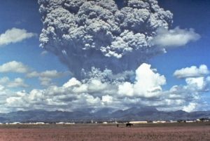
Less than a year has passed since lava stopped sputtering from Iceland’s Reykjanes Peninsula following the first major volcanic outburst from this region in almost 800 years. But now the island is once again bleeding molten rock. The start of a new eruption so soon after unrest in 2021 seems to underscore that this once quiescent peninsula has awoken from its long slumber.
“This could herald the start of decades of occasional eruptions,” says Dave McGarvie, a volcanologist at Lancaster University.
The new eruption, which started at 1:18 p.m. local time on August 3, sent scarlet ribbons streaming from the base of a small mountain into the uninhabited Meradalir Valley. Located far from populations, the volcanic burbles likely pose little danger to the public, at least in the near term. And this relative safety allows scientists and tourists alike to marvel at the geologic majesty and get excited for a possible onslaught of new scientific knowledge.
After all, each volcanic eruption here provides a “window into the abyss,” McGarvie says. The 2021 event yielded revelations about the personality of the peninsula’s exuberant eruptions—from their physical behaviors to their quirky chemistries. This new eruption promises even more insights as the nascent volcano forges the world’s youngest land.
It’s still unclear how prolific or lengthy the eruption will be; this information will only come to light with more time and continued monitoring. But this week’s show of fireworks strongly hints the peninsula will become one of the most volcanically active parts of the planet for several generations.
“I am genuinely excited,” McGarvie says.
A volcanic double-bill
…